top of page

The one-stop tropical weather graphical portal for boaters and beach goers.
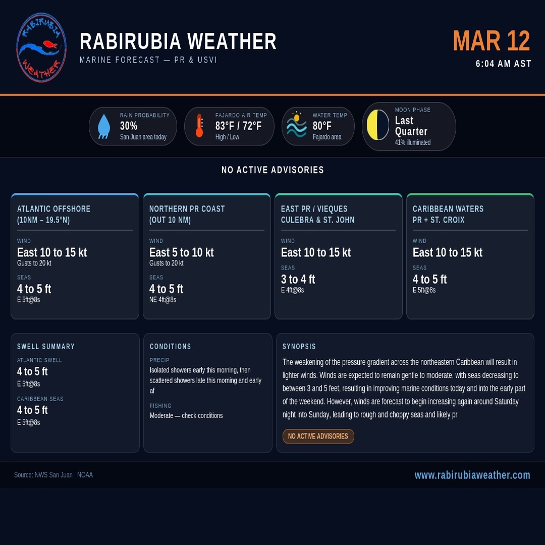
Marine Forecast Puerto Rico & Caribbean Waters

NHC - Tropical Weather Outlook
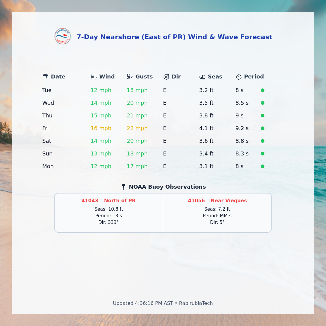
Near Shore Wind & Wave Forecast & Buoy Current Conditions
Live Webcams: PR, Virgin & Leeward Islands.

Caribbean Satellite (Band 16)

Puerto Rico & Caribbean NexRad

Puerto Rico Satellite

Tropical Weather Outlook

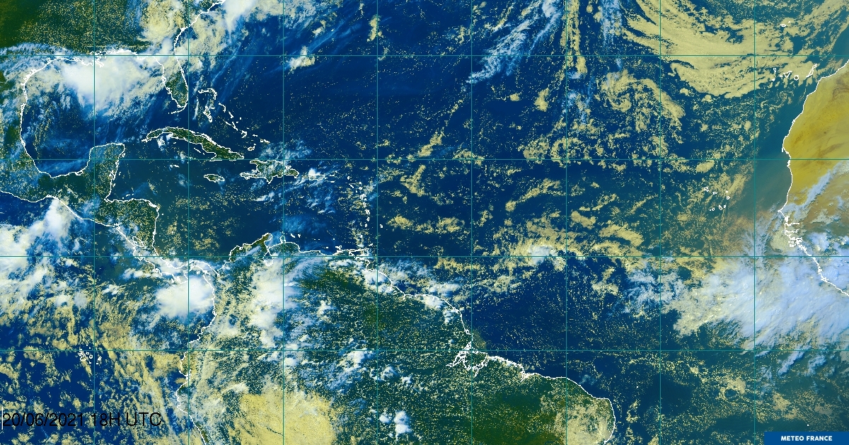
Tropical Atlantic Satellite

Tropical Satellite, by NextWeather
NWS Southern Region Tropical Webpage
Sahara Dust Forecast, by Fox(26)Weather

GOES 16 Puerto Rico Band 8

2026 Hurricane names
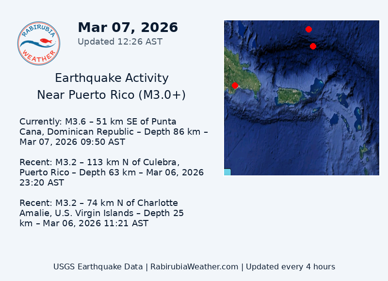
Earthquake: Latest three earthquakes near the forecast region
PR Graphical Forecasts

5 Day GFS Model Futurecast, by FoxWeather

GOES East SAT
Wave height forecast (by NWS)

Watches and Warnings for PR
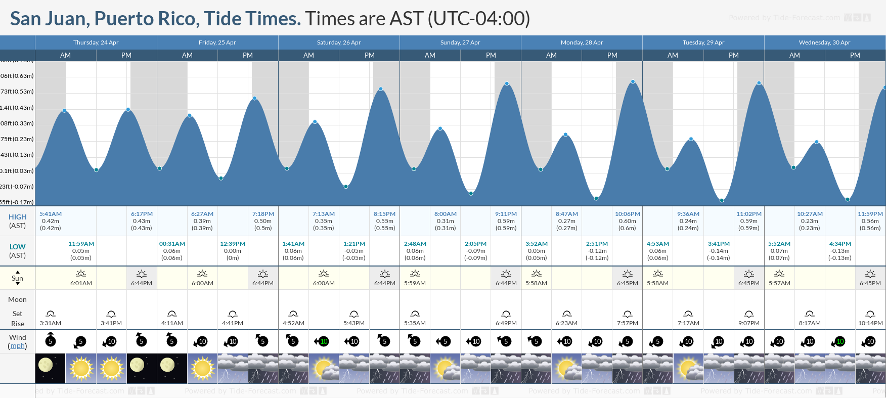
Tide Table (SJU)

Tropical Atlantic SAT

Experimental Weekly Sargassum Inundation Risk
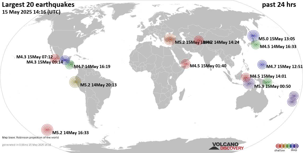
PR Sismic Activity - Earthquakes

Luma - Service Status

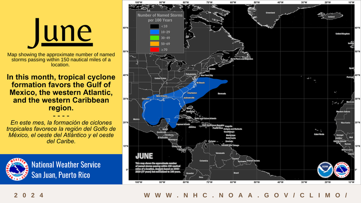
Tropical Development Forecast
Meteo Radar Sat/Radar Combo
NWS SJU Advisories
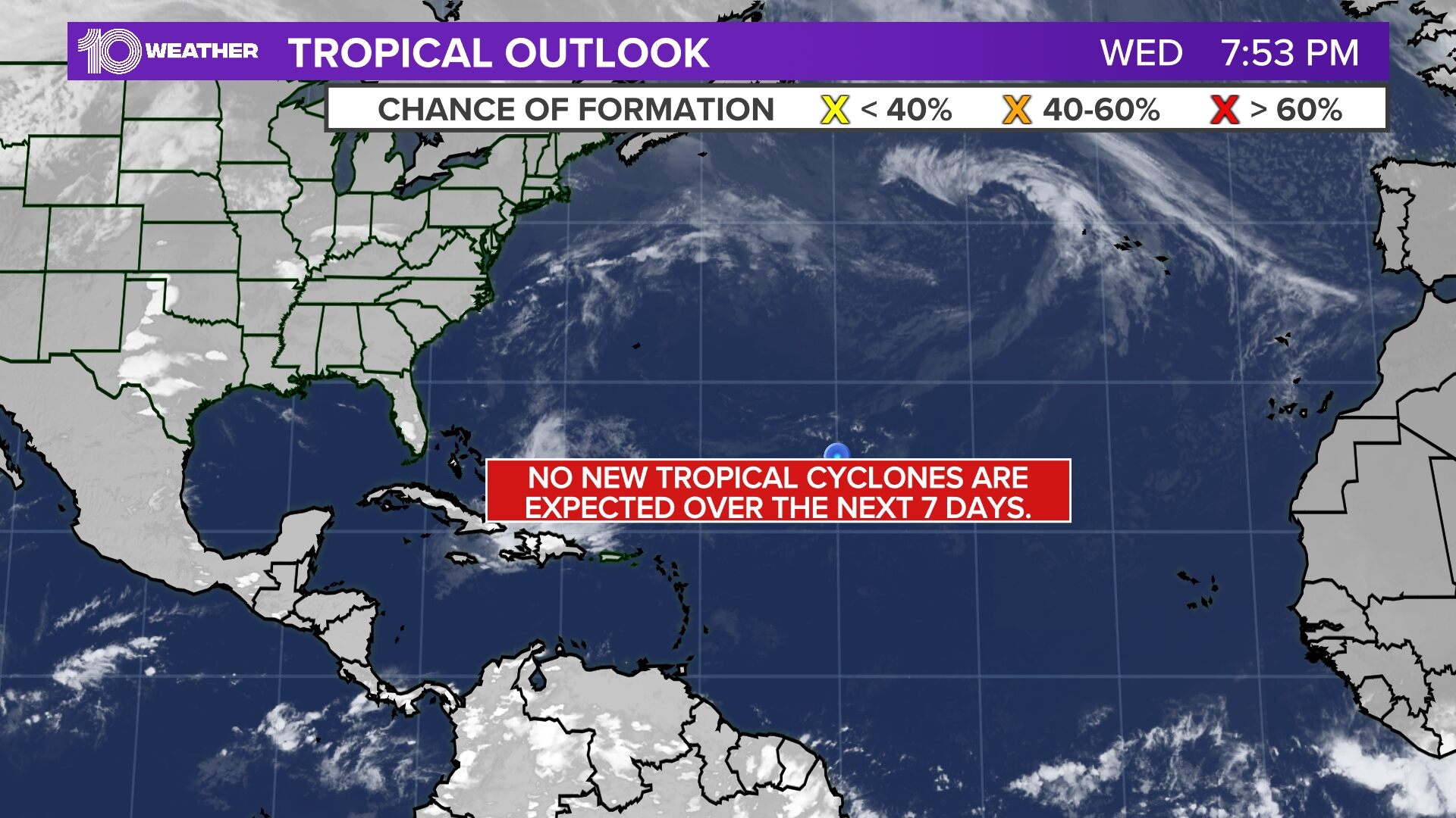
Tropical Outlook

Dust Aerosol Thickness

Total Precitipable Water

Dust Map (SAL)

SJU Marine Forecast by NWS

Africa Animate SAT

Sea Temperature

Sea Surface Temp

Gulf of America SAT

CARICOOS Wind Observations
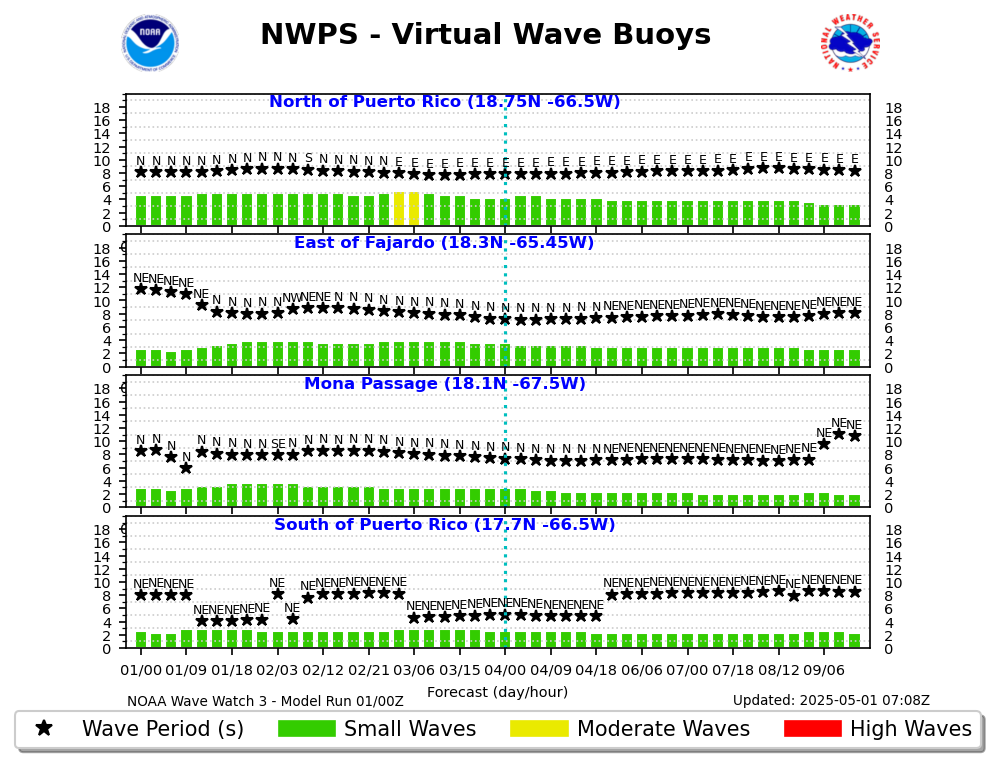
Virtual Wave Buoy

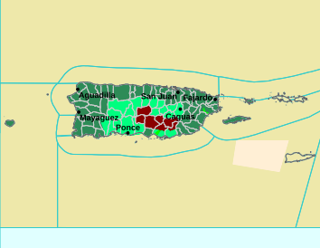
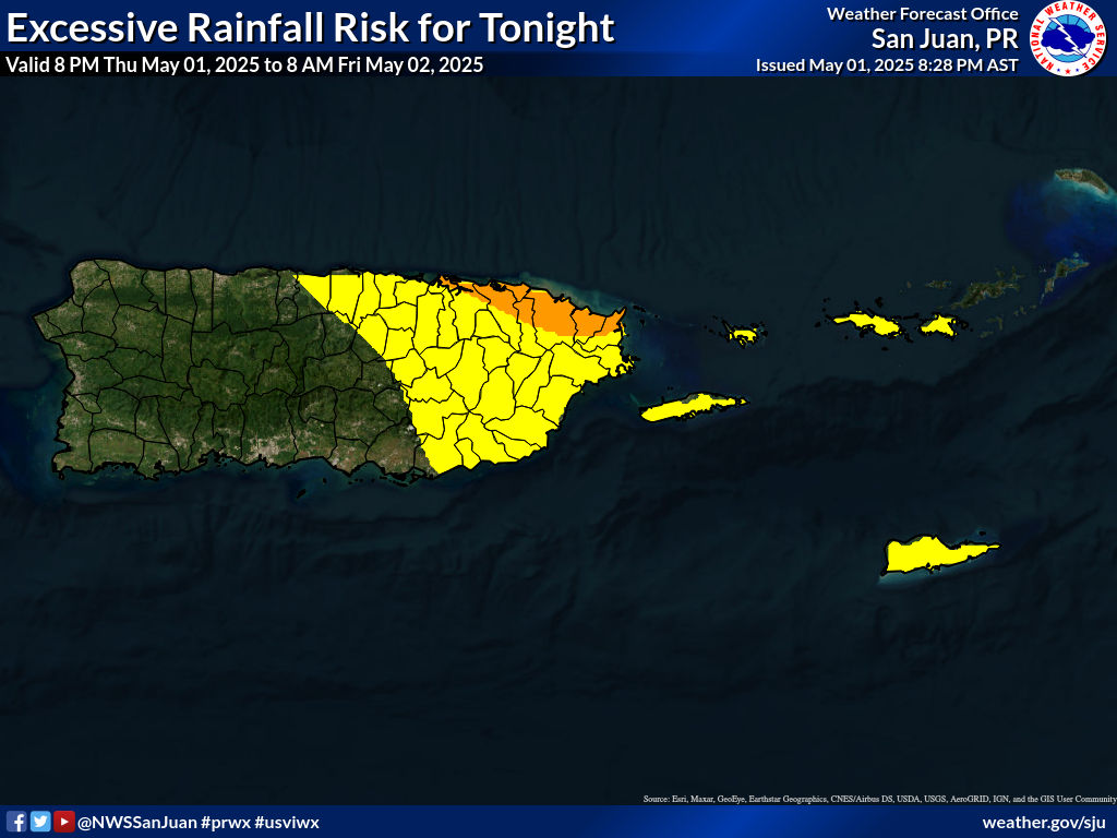
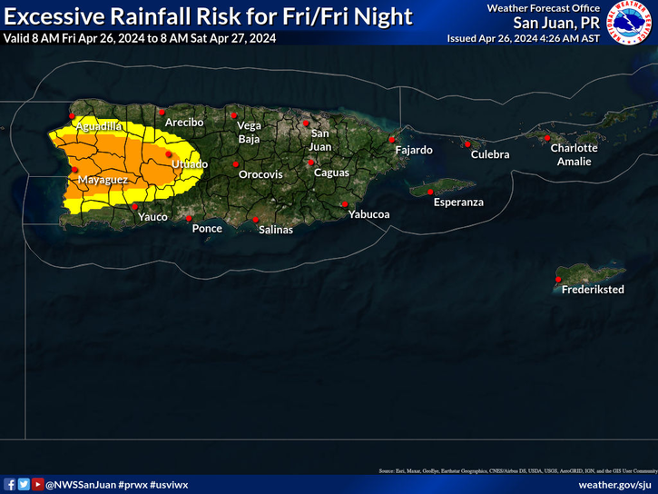
Risks for Today (by NWS)
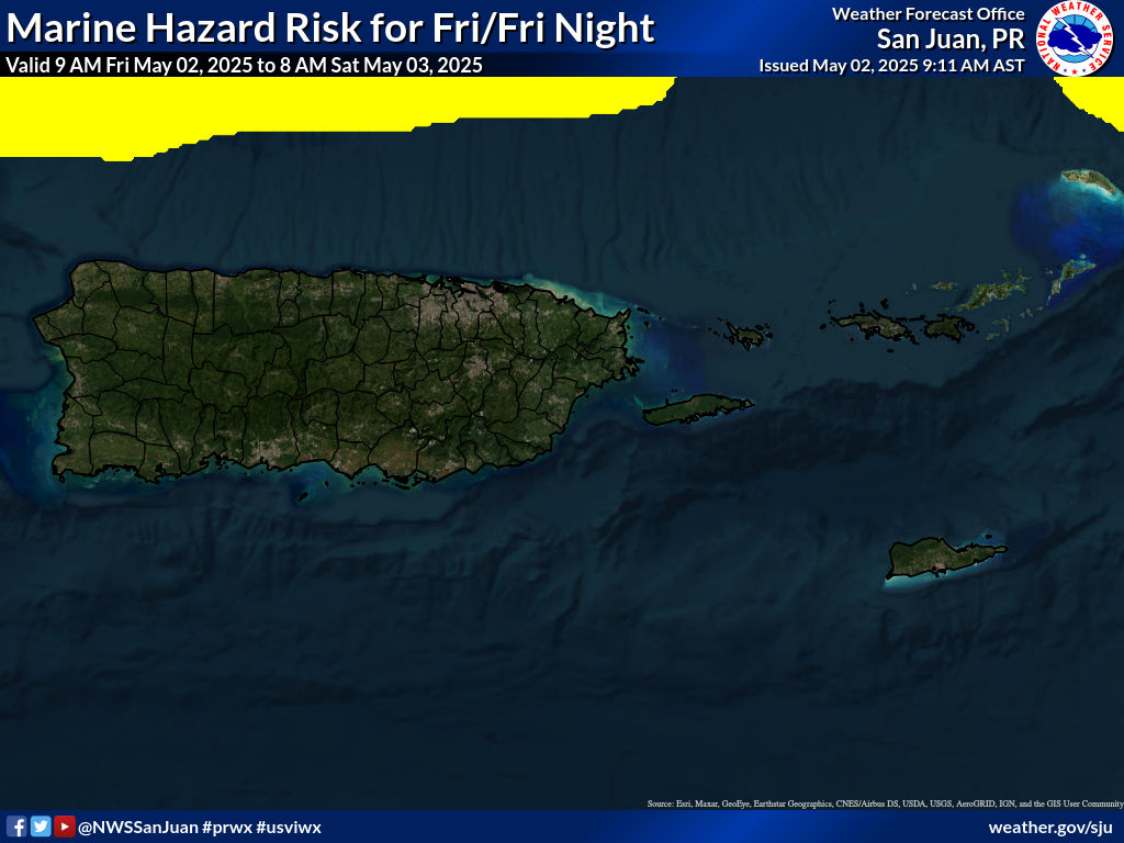
Marine Hazard
Flood Forecast
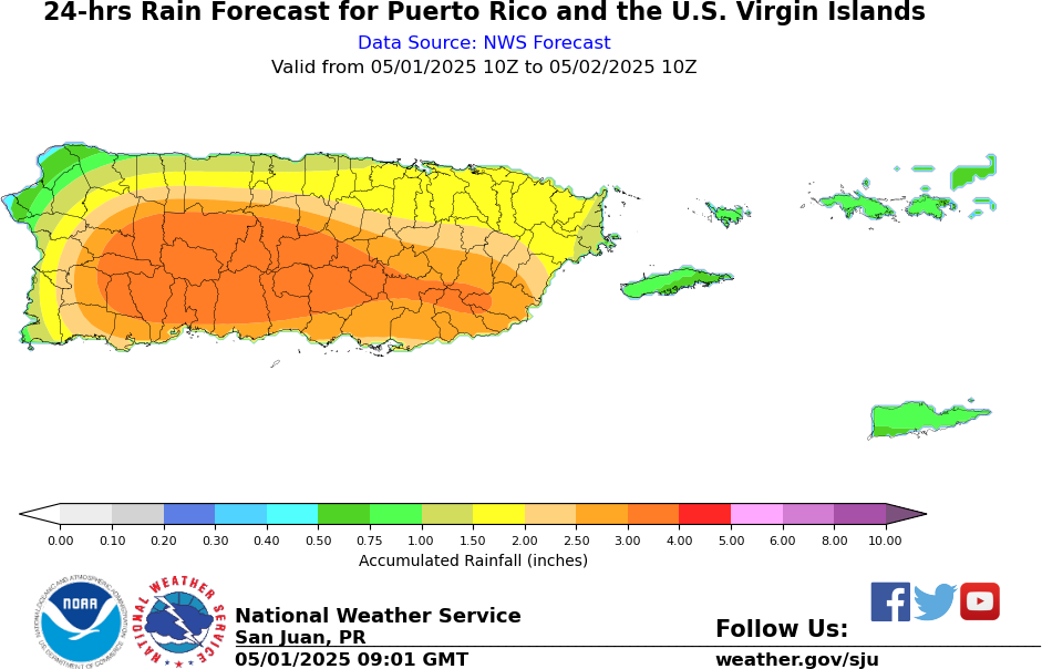
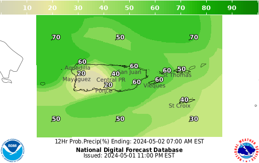
Rainfall Forecast
Marine Hazards

Rainfall Accumulation - Day 1

Rainfall Accumulation - Day 2

Rainfall Accumulation - Day 3
Precipitation Model 24Hrs Guidance
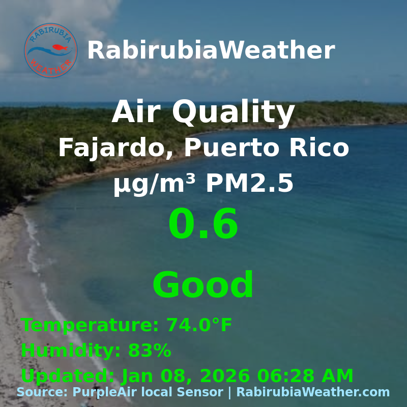
Air Quality - Fajardo, PR
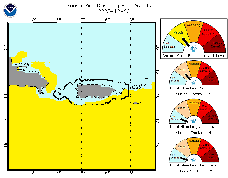
Puerto Rico Bleaching Alerts
Visibility HRW
Precipitation Total
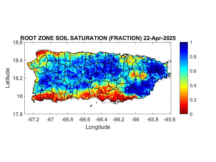
Soil Saturation
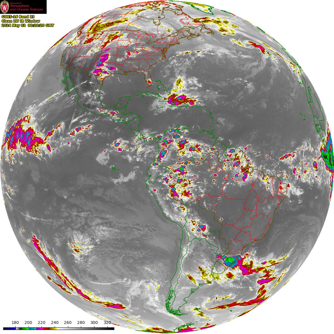
Full Disk

Follow us on Facebook - @rbrwx

Africa Satellite
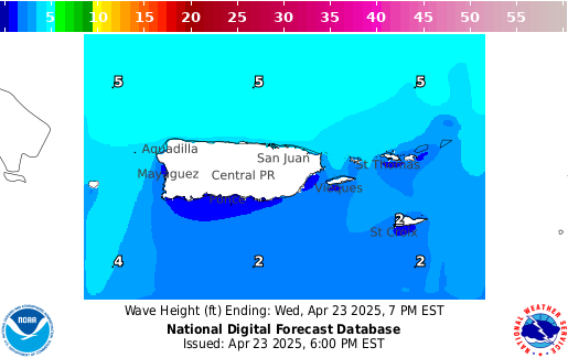
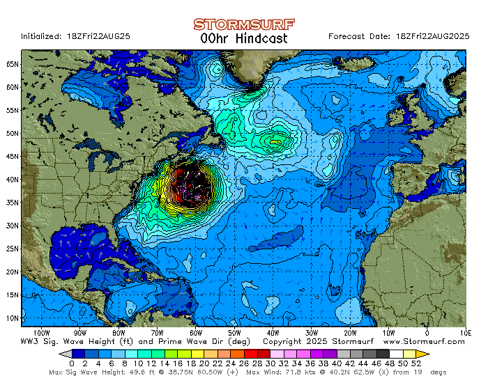
Wave Height
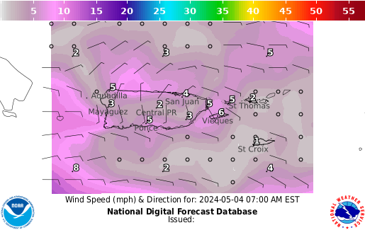
Wind Speed

Moisture

Surface Color

Air Quality Index
Islands Forecast
Wave Forecast

MeteoSAT Africa

Africa SAT-Color

Sahara Dust Map (Africa)

Real Time Weather Threats
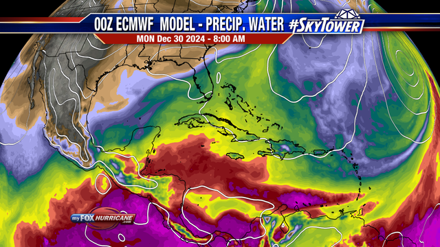
Precitable Water

Forecast Wind Conditions

Live Webcams - Checkout the live webcams
Goes East Animations

Climate Prediction

Tropical Analysis Forecast
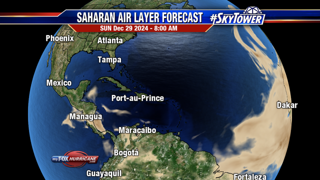
Sahara Dust Map 2
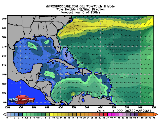
Wave Height Modeling

Follow us on X.com - #rabirubiawx
Wind Speed - 41052 - St. John
Wave height @ 41043
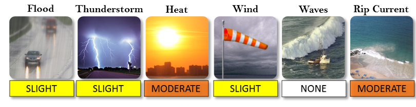
Threats
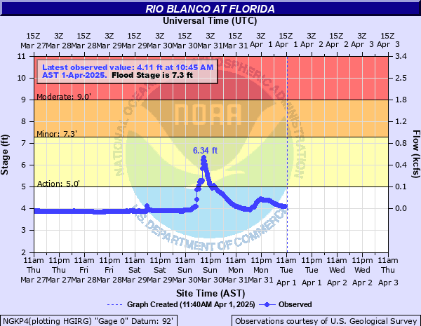
Flood Conditions
National Mosaic Radar

Full Disk Satellite
Full SAT

Conus Animated
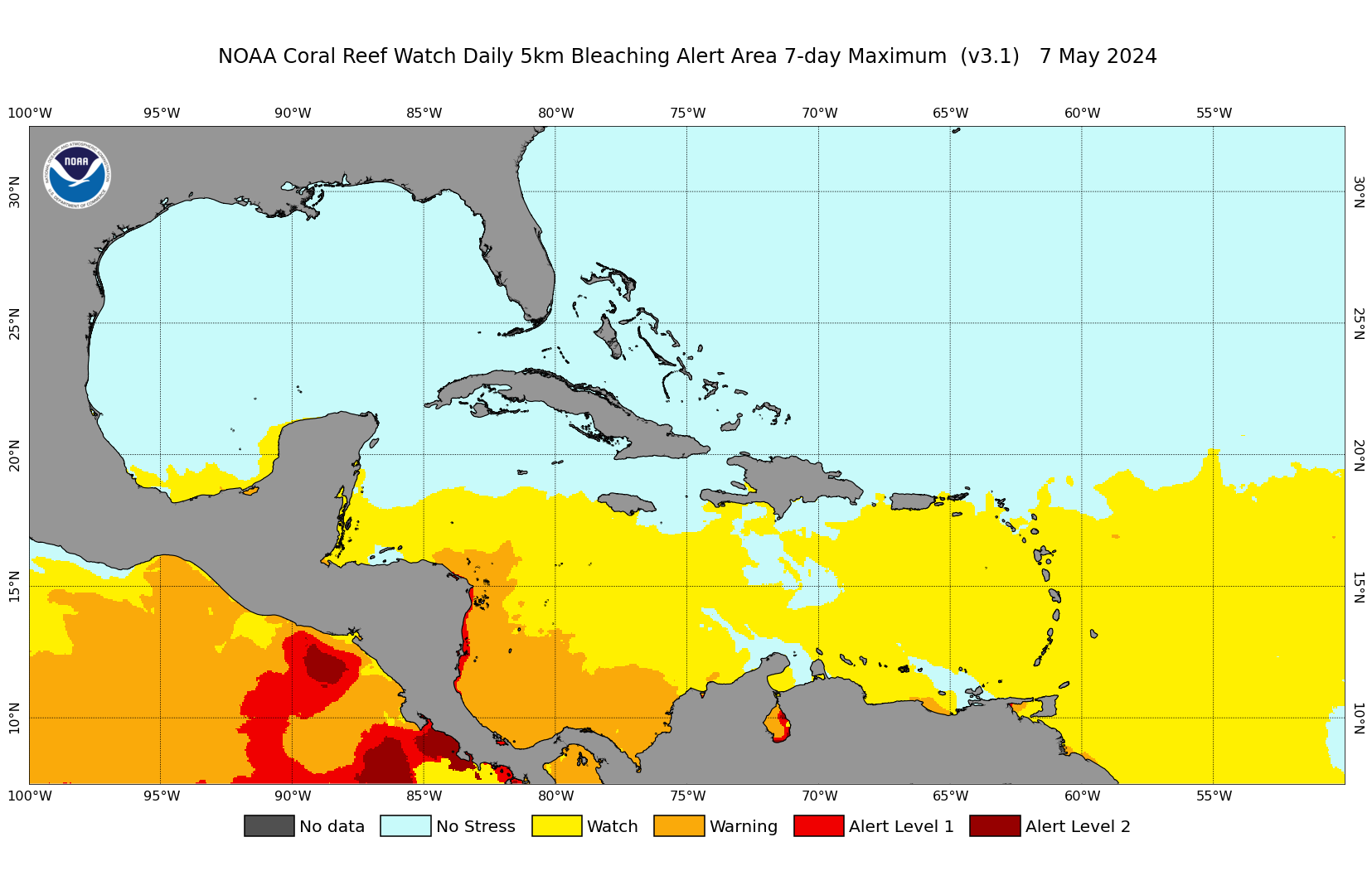
Satellite Coral Bleaching

Sector San Juan USCG Port Status
bottom of page